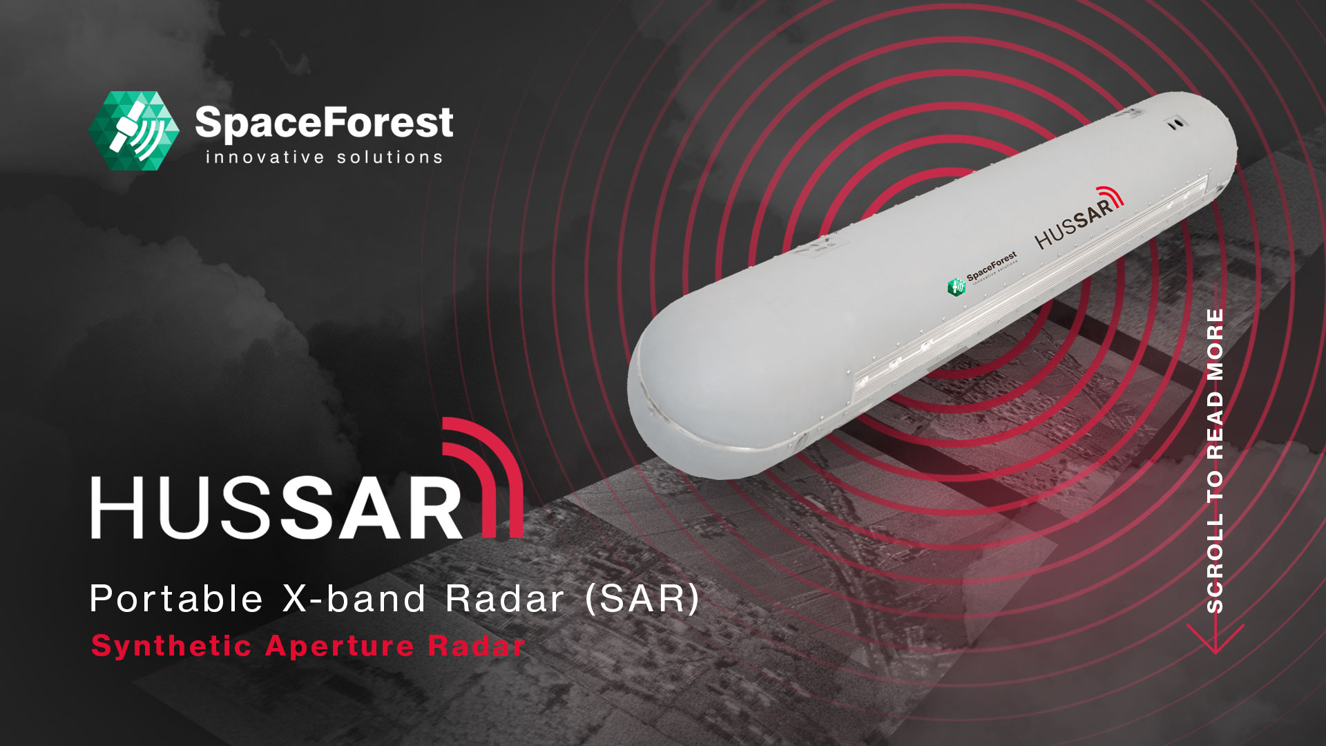
HUSSAR by SpaceForest
Portable X-Band Synthetic Aperture Radar
FEATURES & BENEFITS
- Range up to 10 km
- Resolution 15 cm
- Operation speed 75 – 200 km/h
- Max altitude 5 km
- Operating on Strip SAR mode
- Antenna with gimbal stabilization
- Ground base post-processing station
- Linear polarization
- FMCW radar (LPI – Low Probability Interception)
- GMTI (Ground Moving Target Indication
- Built-in real-time SAR procesor
- Spotlight (highest resolution)
ABOUT HUSSAR
HUSSAR portable X-band radar (SAR – Synthetic Aperture Radar), which can be attached to an unmanned aircraft, allows terrain scanning and motion detection using electromagnetic waves with a resolution of up to 15 cm.
Radar is a valuable tool for monitoring security areas, especially critical areas such as national borders, where it is used by border guards, police and military personnel. Its effectiveness is increased by the ability to operate regardless of weather conditions and time of day, thanks to the capabilities of systems such as HUSSAR (X-band SAR). This ensures continuous surveillance, day and night, providing critical support to security operations.
One of the key advantages of radar technology in such contexts is its ability to detect and track suspicious or unauthorized drones and vehicles, strengthening security measures and enabling rapid responses to potential threats. In addition to security applications, radar is widely used in cartography, surveying and land mapping, where it helps precisely delineate and understand geographic features and landscapes, contributing to fields ranging from urban planning to environmental monitoring.
OPERATION DIAGRAM
Check the diagram how HUSSAR works, learn about its key functional features and technical parameters that distinguish it from other radars (SAR)

| Parameters | Minimal | Typical | Maximal | Unit |
|---|---|---|---|---|
| Frequency range | 9 | | 11 | GHz |
| Antenna polarization | | V/V | | |
| Range (radar to target) | 150 | | 10000* | m |
| Max altidude | | | 5000 | m |
| Finest range resolution | | 30 | 15 | cm |
| Finest range cross-resolution | | | 30 | cm |
| Elevation angle of the beam | 25 | | 65 | ° |
| Supply voltage | 36 | | 52 | V |
| Supply power | | | 180 | W |
| Antenna stabilization in azimuth (mechanical) | -20 | | 20 | ° |
| Weight | | | 10 | kg |
| Temeperature range | -10 | | 50 | °C |
| Dimension (LxWxH) | 120 x 20 x 20 | cm | ||
| Digital control interface | Ethernet | |||
| Data storage interface | USB | |||
| Housing material | Kevlar-reinforced composite | |||
| Image / video stream files extension | JPEG / MPEG | |||
| Mechanical mounting interface | Customizable according to client requirements | |||
| Operation modes | Stripmap, Spotlight, GMTI | |||
Download and print the HUSSAR data sheet
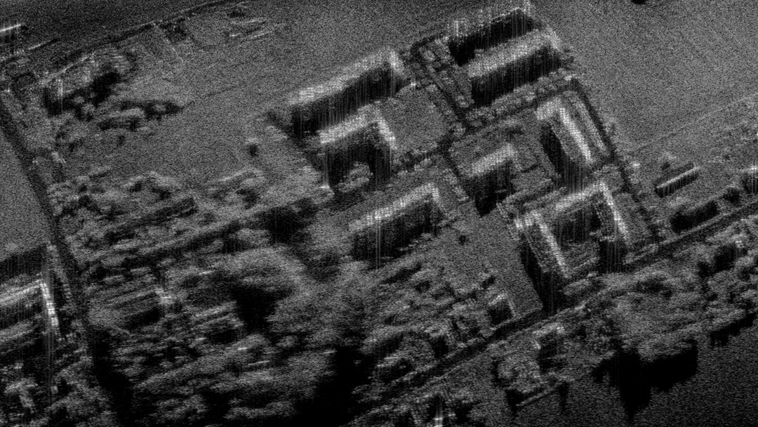
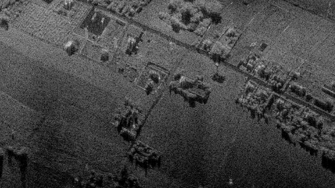
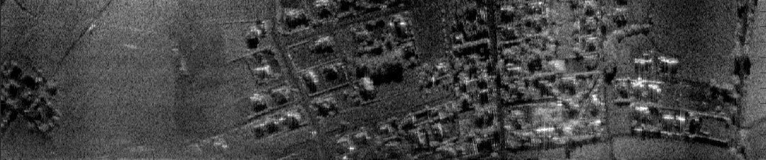
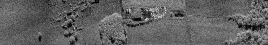
Examples of terrain imaging using the HUSSAR
Get open to cooperation by purchasing or renting a radar or the entire system (radar + application)

FAST CONTACT
If you want to talk about radar, call:
+48 58 770 56 46 or go to the contact form